Increasing Accuracy - Existing Conditions Verification
January 13, 2021
An Opportunity to Increase Accuracy
Construction teams working in the Greater Boston area are often renovating older buildings that may have had many modifications over the years. As a result, as-built drawings are generally viewed with a high degree of skepticism and are regarded as inaccurate or incomplete. Working with questionable information can be especially difficult while planning for a building addition or new mechanical equipment on a roof. Dealing with these undocumented conditions can cause costly and time-consuming problems for the project team.
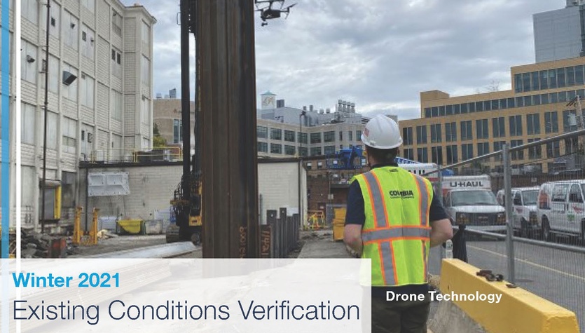
Drone Technology
Faced with planning a new addition within a constrained site, Columbia utilized drone technology to scan the existing exterior façade. The drone captured data and then processed that real-world information into a point cloud model, which was inserted into the design model. This process enabled the project team to properly plan construction detailing by capturing the actual conditions and bringing them into the digital world. Key benefits include:
- Saved time documenting existing building conditions. An exterior building scan with the drone takes roughly 30 minutes of flight time and a 3D file is ready for use within 24 hours.
- Verified existing conditions rather than rely on questionable or outdated as-builts to confirm the building expansion could be constructed as planned or adjusted as needed.
- Produced a high-resolution image of the entire building for crane and other logistics planning.
- Shared a 3D model with the team via the web allowing easy access without downloading additional software.

Drone Data
